
Sources for Monroe Neighbors
No single public record lists every person on a Monroe block. The city map supplies geographic context, the assessor links parcels to assessment names, the Clerk keeps recorded instruments, and election tools answer limited voter questions. Planning files, permits, old directories, and community listings describe different layers. The coverage table leads with what each source can actually support.
| Source | What It Shows About a Block | Access |
|---|---|---|
| City ArcGIS viewer | Adjacent parcels, street labels, city layers, and public features | Browser map; live popup fields were not captured |
| Assessor/DataScout | Assessment names, situs, parcel, and tax context for nearby lots | Free search described by assessor |
| Clerk deed index | Recorded parties and legal descriptions by parcel | Clerk Connect or eClerks; some access paid |
| Louisiana voter records | Address, precinct, district, and registration clues | Public portal or regulated list request |
| Planning and MGO | Land use, districts, projects, permits, and case events | City pages and dynamic portals |
| Community sources | Organization or business affiliation leads | Membership pages, not resident rosters |
An assessment name is not proof of present occupancy. A mailing address may differ from the parcel's situs address, meaning the physical location being assessed. A deed establishes a recorded transfer, not who sleeps at the site today. Keep each fact in its own column, along with the date viewed. That approach makes nearby parcel research useful without turning a block map into an unsupported household claim.
Think in four layers. Physical neighbors are adjacent parcels and public corridors. Civic neighbors share a project, district, or meeting item. Historic neighbors appear beside one another on a dated map or in an old street section. Institutional neighbors include schools, libraries, churches, cemeteries, and public facilities. State the layer every time. Two lots can touch on a map without showing any friendship, family tie, shared home, or common activity.
Monroe Neighbor Voter Clues
The Louisiana Voter Portal address route accepts ZIP code, address, apartment or lot, and city. The research capture below shows the official input screen used to check one voter record. It is not a block roster and should not be queried as if it listed every person at nearby homes.
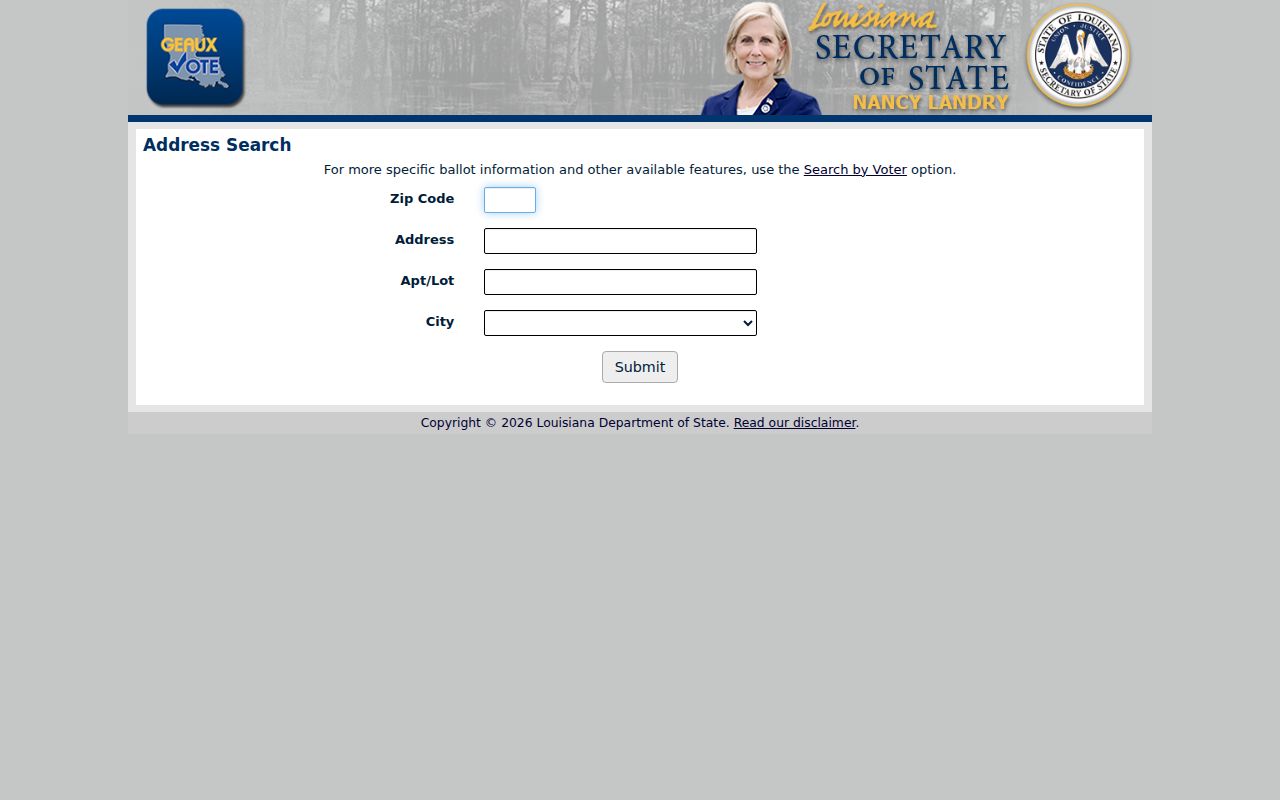
The result can add registration, precinct, and district context for the person searched. Louisiana protects full birth dates, Social Security and driver-license data, most email information, a mother's maiden name, and protected addresses. The Address Confidentiality Program creates further safeguards for qualifying relocated survivors.
A purchased voter list follows a separate process with criteria, an application, an advance estimate, payment, and delivery. Portal output and list output are not interchangeable. For a personal block question, use the least specific official route that answers it.
The portal's disclaimer is part of the record trail. Save it with the date and, when a formal list is involved, save the current Registrar contact information too. Addresses can be protected or updated, and a failed match may reflect input format rather than absence. Check the street suffix, apartment or lot value, ZIP, and city label before drawing any conclusion. Voter status does not establish a complete household, ownership, or a person's daily presence.
Monroe Neighborhood Partners and Gaps
No complete, official, current Monroe neighborhood-association directory was found. The Keep Monroe Beautiful page refers to neighborhood associations as community partners, but it does not publish a full roster, boundaries, or contacts. The captured page documents that narrower claim.
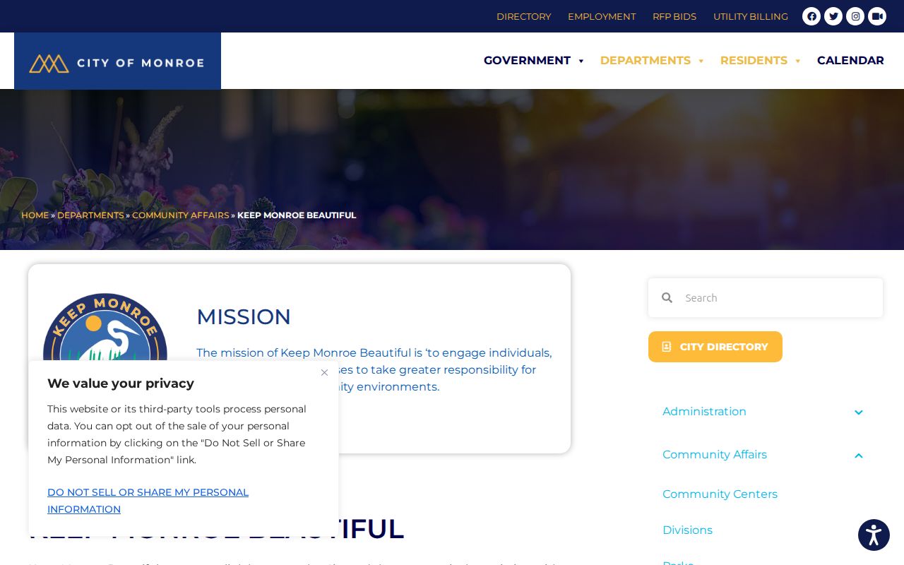
Do not turn that reference into a list of active groups. Confirm an association's name, service area, date, and current contact from the group itself or a city document.
| Keep Monroe Beautiful | Umbrella community lead; no complete association directory on the page |
|---|---|
| Monroe Chamber directory | Keyword, category, and A-Z organization browsing; membership is not a boundary |
| Park View Civic Club | Historical 1947-48 city directory lead only |
| Park View Civic Garden Club | Historical lead; current continuity unverified |
| Welcome Garden Club | Historical lead; current continuity unverified |
| Formal HOA list | No verified public current inventory located |
Historical club names offer a snapshot, not a bridge to the present. Park View Civic Club, Park View Civic Garden Club, and Welcome Garden Club appear as leads in the 1947-48 directory. Cite that edition and section if the names matter to a block history. A present-day claim needs a present-day source. If an association responds, record whether it is a nonprofit, subdivision group, civic club, or informal network and ask for the boundary it actually serves.
Map Monroe Neighbors Carefully
The City of Monroe interactive map is the geographic starting point. Its public page was confirmed, but the research did not capture every live layer, popup field, or selection tool. Use only the labels and fields visible during the session. Then compare the same parcel with the Ouachita Parish Assessor, whose free real-property route supports owner and address searches.
- Normalize the mailing address and confirm that it belongs to Monroe rather than West Monroe or another parish place.
- Locate the site on the city map and note the surrounding parcel shapes, street labels, and public features.
- Open each nearby parcel separately in the assessor search. Record the parcel number, situs, assessment name, and date.
- Use the Clerk deed index only when a recorded owner or legal description is needed. Do not treat an assessment field as title.
- For a full named street instead of the immediate block, switch to the street workflow.
The process is address to map, map to parcel, parcel to assessment, and only then assessment name to deed. Each step answers a different question. The Monroe street directory carries that chain along an entire named street, while neighbor research should stop at the radius relevant to the question.
Monroe Neighbor Records in Meetings
The planning and zoning office can show an official district, land-use rule, historic designation, or meeting item. Council agendas may identify a project affecting several parcels. Code enforcement and MGO may add address-linked complaints, permits, inspections, or project events, but the research did not establish complete public field coverage for those dynamic portals.
Labels matter. A historic district is not the same as a subdivision, planning district, civic club, or colloquial neighborhood. A complaint or scheduled hearing is also not a final finding. Cite the agenda, staff report, map, and final action when available. If a person speaks during public comment, the meeting record supports only that dated statement and does not prove where the speaker lives.
Monroe and West Monroe sit across the Ouachita River in the same parish. Their municipal records can diverge even when a mailing line or shared historic directory creates the impression of one place. Confirm which city holds the map, permit, or meeting record before linking it to a block.
Older neighborhood context may come from the OPL city directories, newspaper files, Sanborn maps, or ULM images. A strong block history pairs one dated map with one meeting or newspaper item and one parcel or building record. Keep the dates visible. A 1932 footprint, a 1947-48 listed organization, and a current planning district describe three different moments. They should enrich one chronology without being blended into a claim about present people.
Monroe Neighbor Community Directories
The Monroe Chamber member directory has keyword, category, Go, and A-Z browse controls. It can identify businesses or organizations connected with a public story, but membership does not prove a residential address or city boundary. The research image below shows the available browsing route.
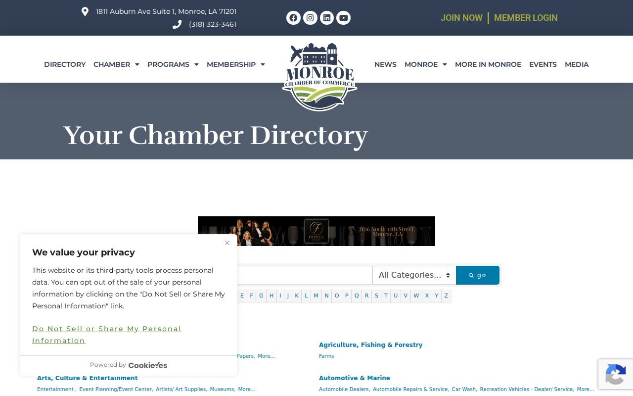
For an organization, save its category, listing date, and mailing address, then compare the entity name with the Louisiana Secretary of State commercial record. The filing may confirm legal status, but it still does not show where every activity occurs.
| Official or archival source | Compiled neighbor tool |
|---|---|
| States who created the record and why | May merge facts from several dates |
| Provides a record date and custodian | Source date may be unclear |
| Lets a reader check a parcel, filing, or meeting | May imply relationships that no source proves |
Official sources take more steps, but their limits are visible. Commercial neighbor tools should never replace the dated parcel, voter, meeting, or organization record.
A business or civic listing can still be valuable. It may show that an organization used a mailing address near the block or took part in a public project. Verify the exact organization name, then look for a council item, newspaper notice, or state entity filing from the same period. Do not transfer a listed business address to an officer, employee, member, or volunteer. The record concerns the organization unless it explicitly says otherwise.
Monroe Neighbor History Through Cemeteries
The Louisiana Cemetery Board listings identify licensed cemeteries and contact leads around Monroe. Named examples in the research include Old City Cemetery near 18th and DeSiard, Richwood Gardens, Riverview, St. Alban's Columbarium, St. Matthew, St. Paul's, St. Thomas, Sutton Family, and Brown Family cemeteries. The captured state listing is an access point, not an interment database.
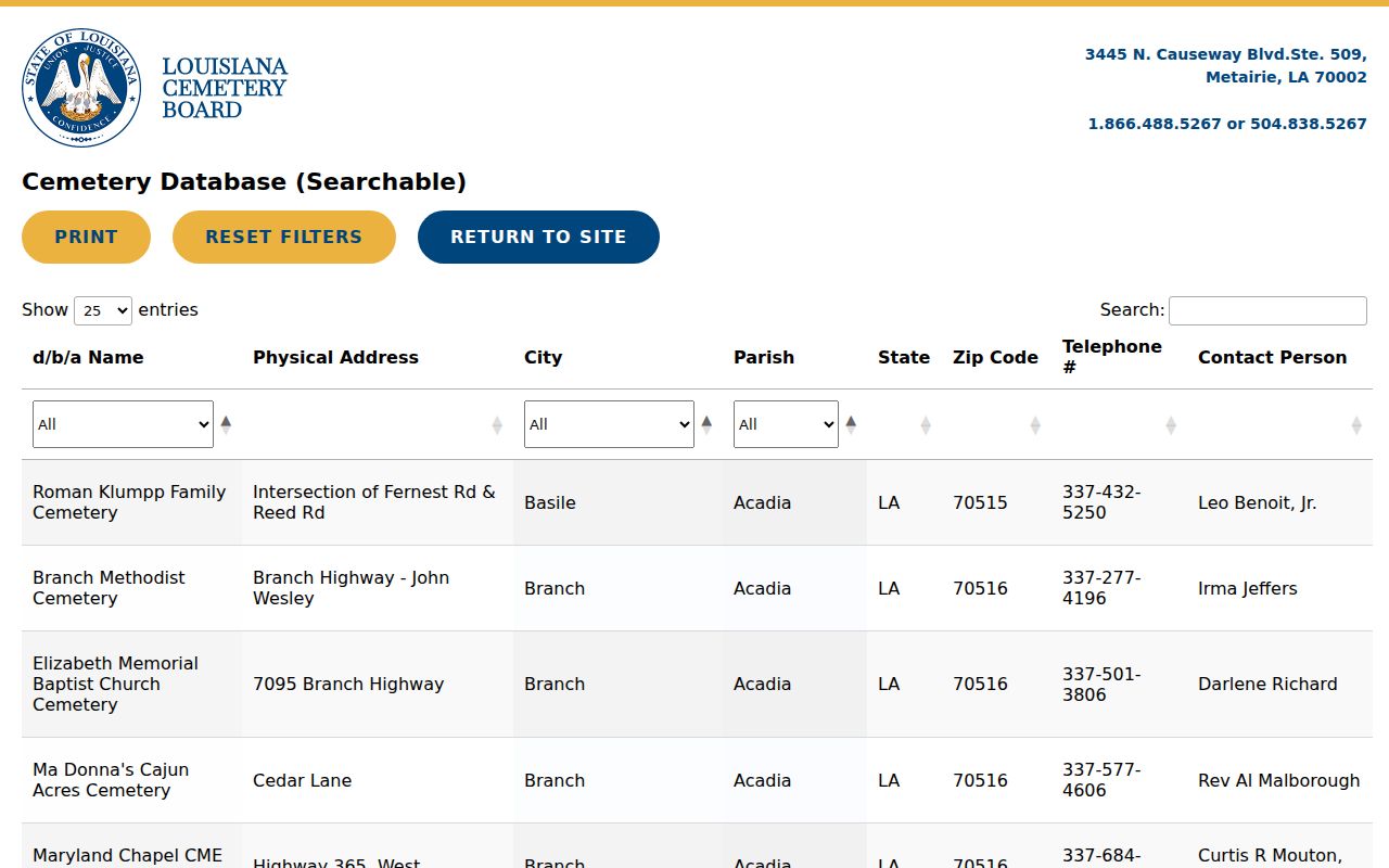
A cemetery custodian may help with a memorial question. Confirm a person through the cemetery's own record, an obituary, a marker image, or an archival source. A nearby cemetery is an institutional neighbor and part of the block's history, not a list of current residents.
For a historical street story, note the cemetery's licensed name and contact route, then ask the custodian what records exist. An obituary may add family and funeral details, while a marker image can confirm dates. Each needs its own citation. Proximity to a cemetery can explain a street name, public project, or map feature, but it does not support an inference about nearby households.
Protect Privacy of Monroe Neighbors
Public maps cannot disclose every non-owner household member, private utility customer, delivery recipient, or motor-vehicle address. The voter portal is a regulated election tool, not a house-by-house roll. Louisiana's Address Confidentiality Program provides substitute-address protection for qualifying survivors, and protected voters should work with the Registrar of Voters. Never publish a protected address, private phone number, daily routine, or household relationship inferred from separate records.
Use the least specific detail that answers the civic or historical question. “Adjacent parcels shown on the city map” is more accurate than calling assessed owners friends or relatives. “A meeting item concerned the street” does not mean every named attendee lives there. Dates and source labels prevent old directory entries from being mistaken for current neighbors.
Lawful use. Monroe neighbor records are for legitimate personal, civic, and historical questions. Never use them to stalk, harass, intimidate, or harm anyone.